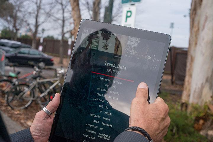
Imagine a world in which a groundskeeper at Stanford can stand in front of one of the more than 43,000 trees on campus and – through an app on his or her smart device – can instantly access dozens of attributes for that specific tree, such as when it was planted, last trimmed and fertilized.
Thanks to the IT Maps and Records team in Land, Buildings and Real Estate (LBRE), that world is becoming a reality.
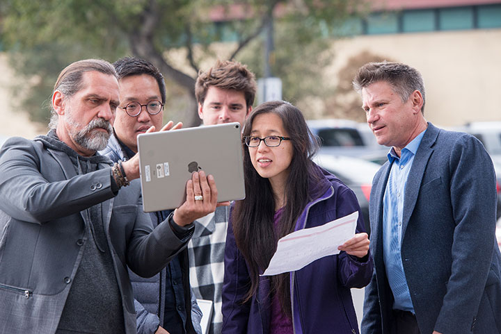
Led by Swati Prabhu, associate CIO for LBRE, the team spent the past year investigating and piloting augmented reality (AR) technology with two LBRE groups – the grounds team for trees and the utilities team for infrastructure. The goal is to provide LBRE field crew quick, easy access to live digital information, saving time and increasing data accuracy from traditional paper map processes.
“This tool is allowing us to provide more data – and quicker access to it – than what we can offer on a two-dimensional paper map,” said Prabhu.
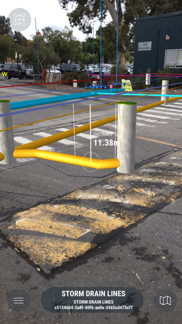
AR is an interactive technology that expands our physical world by adding layers of digital information onto it, such as sounds, videos, graphics. By linking LBRE’s mapping data in the Geographic Information System (GIS) manager to a vendor AR technology solution, an LBRE grounds or utility team member can stand in front of a tree or over an underground pipe and instantly access attributes such as a tree’s age and height or a pipe’s depth and diameter, through an app installed on his or her smart phone or device.
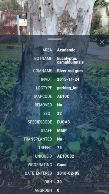
“Based on where you are standing, the technology maps your location to information in our data repository, and provides a live data stream of information that’s not visible to the naked eye or available on a paper map,” said Prabhu. “It makes it incredibly easy to access, navigate and interact with our GIS data while you’re in the field.”
Smart campus concept
With industry trends rapidly moving towards a smart campus, Prabhu and her team recognize the need to embrace these developments and explore more innovative technologies in their work. Experimentation with AR and VR (virtual reality) technologies are also part of a location intelligence program at Stanford that aims to explore space management, map-based data analysis, 3D models and more, said Prabhu.
The focus of this effort, documented in the 2018 Campus IT Plan (pdf), was to discover available offerings in the AR space and beyond, define use cases and business requirements, and pilot technology to gain experience with it and explore whether it could eventually replace current physical map processes.
“Today, this is an additional tool for LBRE teams to use, but they still have to look at traditional drawings,” said Wilson Lee, GIS manager on the LBRE IT Maps and Records team, who managed the technical integrations of the vendor solution and the GIS data repository system. “The ultimate goal is for this technology to eventually replace the need for them to go out with paper maps.”
What’s next?
The LBRE IT Maps and Records team will continue to pilot the AR technology for internal operations in LBRE by expanding it to more users (currently there are about eight LBRE staff using it), and adding the Microsoft HoloLens, a mixed reality headset, to create an even more immersive and richer experience.
The team will also explore additional scenarios where this AR technology could benefit other parts of LBRE and Stanford.
Prabhu and Lee shared just a few ideas for how AR technology could benefit other parts of Stanford, including include:
- The construction or redesign of new or existing spaces on campus to visualize future spaces
- A reimagined visitor’s experience, with enhancements to an immersive walking tour where additional stories could be told upon your arrival at different locations
- Campus or building emergency situations where public safety groups could access operational data quickly
- Underground communications and networking infrastructure
“We can certainly have websites with tons of information, but the value of this is that it’s location relevant,” said Prabhu. “I’m standing here and I can look at information about what I’m seeing in front of me. It takes the real world and adds data to it, making that information readily available without having to look for it.”